Photo Gallery
The NASA Orbital Debris Program Office has gathered pictures and graphics that are found here
in the photo gallery section and throughout the site. These pictures are considered open to
the public and may be freely viewed or downloaded, unless they are included with permission
of the copyright owner, and so noted. The pictures and graphics provide a visual insight into
the depth of orbital debris research.
Click on the small thumbnail image to view it in its full size. To download an image, right
click on the desired image and select Save Picture As... from the menu option of your
browser.
Graphics
The following graphics are computer generated images of objects in Earth orbit that are currently being tracked. Approximately 95% of the objects in this illustration are orbital debris, i.e., not functional satellites. The dots represent the current location of each item.
The orbital debris dots are scaled according to the image size of the graphic to optimize
their visibility and are not scaled to Earth. These images provide a good visualization of
where the greatest orbital debris populations exist.
Below are the graphics generated from
different observation points, as of January 1, 2019. Choose from small, medium, large, and
extra large file sizes. To see the debris in motion, check out our video:
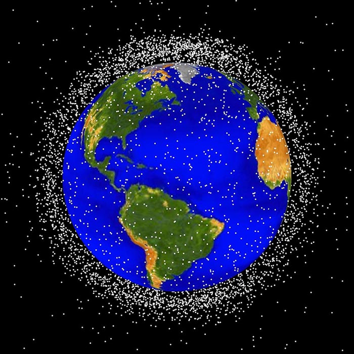
LEO stands for low Earth orbit and is the region of space within 2,000 km
of the Earth's surface. It is the most concentrated area for orbital debris.
Credit: NASA ODPO.
High Resolution JPGs
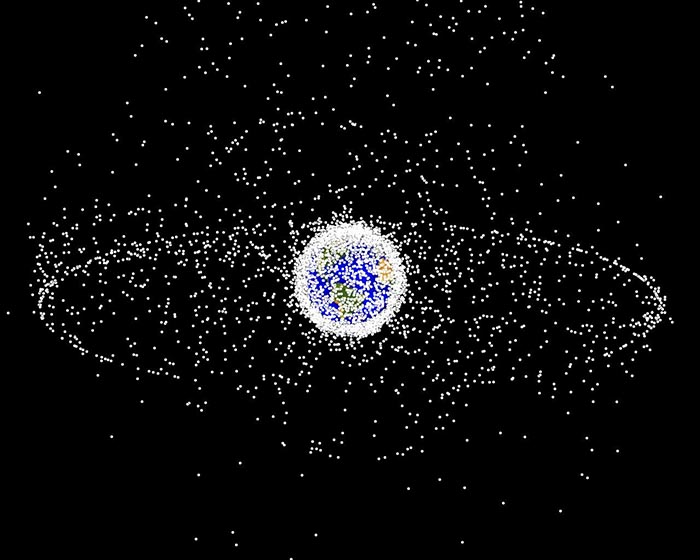
The GEO images are images generated from a distant oblique vantage
point to provide a good view of the object population in the
geosynchronous region (~35,785 km altitude). Credit: NASA ODPO.
High Resolution JPGs
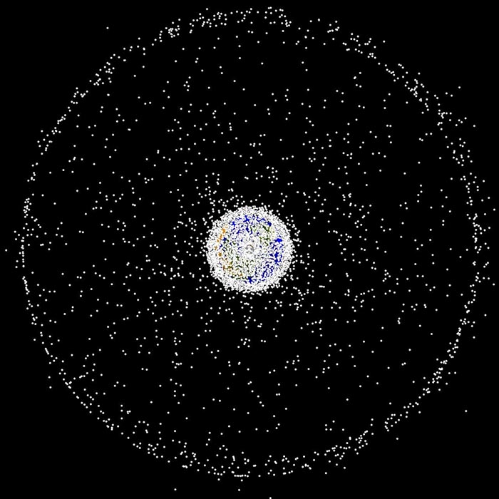
The GEO Polar images are generated from a vantage point above the north pole,
showing the concentrations of objects in LEO and in the geosynchronous region.
Credit: NASA ODPO.
High Resolution JPGs
Radar
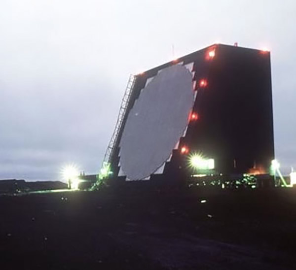
Cobra Dane radar located on Shemya Island, AK. This phased
array radar can detect and track objects as small as 5 cm
and is a contributing sensor to the U.S. satellite catalog.
Credit: AFRL.
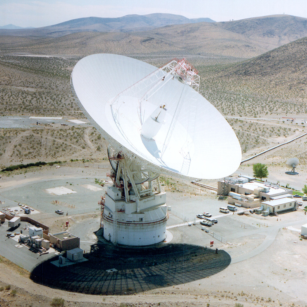
70-m Goldstone antenna located near Barstow, CA. When operated as a
bi-static radar, Goldstone is capable of detecting 2 mm debris at
altitudes below 1,000 km. Credit: NASA JPL.
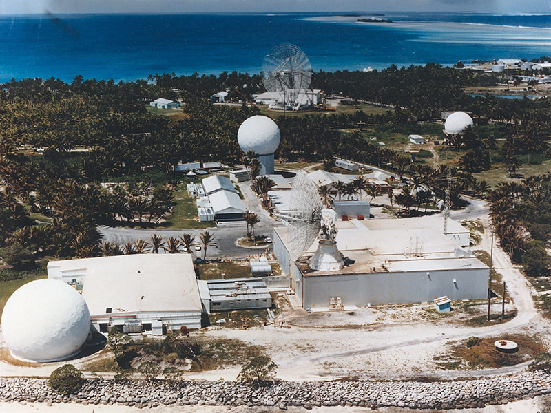
Kiernan Reentry Measurement Site (KREMS) located on Kwajalein
Atoll. Four radars are visible: ALCOR, TRADEX, MMW, and ALTAIR.
Credit: U.S. Army SMDC Photo Gallery.
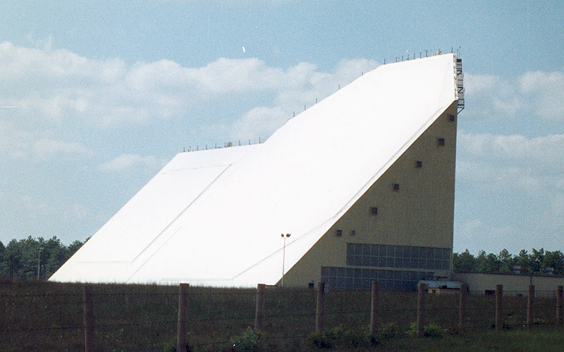
Eglin FPS-85 radar located near Ft. Walton Beach, FL. This phased
array radar is a dedicated sensor to the U.S. satellite catalog.
Credit: NASA ODPO.
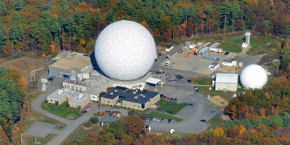
Haystack and HAX radars located in Tyngsboro, MA. These radars collect
600 hrs of orbital debris data each per year. They are NASA's primary
source of data on centimeter sized orbital debris. Reprinted with
permission courtesy of MIT Lincoln Laboratory, Lexington, MA.
Telescopes
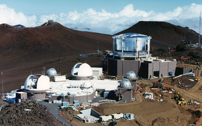
Air Force Maui Optical and Supercomputing (AMOS) site. This optical sensor
suite includes the 3.67-m Advance Electro-Optical System (AEOS) telescope.
Credit: AFRL (AMOS Site Factsheet OPS-17-13034 approved for public release).
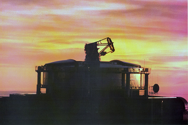
Advance Electro-Optical System (AEOS) located at Air Force Maui
Optical and Supercomputing (AMOS) site on top of Haleakala volcano,
Maui, HI. Credit: AFRL/RDS/MSSC/RA Fugate.
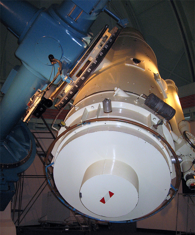
The Michigan Orbital Debris Survey Telescope (MODEST). This telescope is
located outside of La Serena, Chile at the Cerro Tololo Inter-American
Observatory. Credit: Patrick Seitzer, Unversity of Michigan.
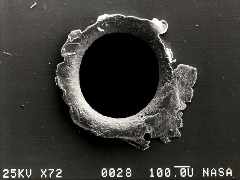
Impacts
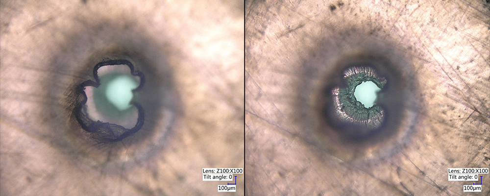
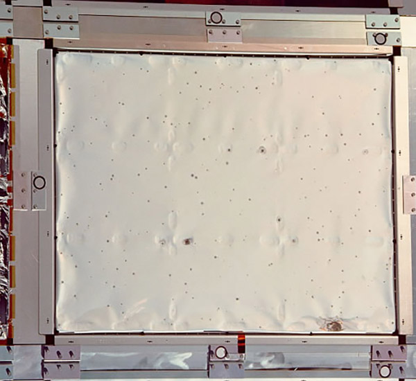
Overhead imagery looking into an impact through-hole on Bay 5 multi-layer insulation (MLI). Left image is focused closest to observer, right image is focused on the exit hole. Credit: NASA ODPO.
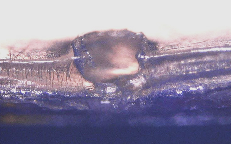
A cross-sectional image of an impact crater on Bay 5 multi-layer insulation (MLI). Credit: NASA ODPO.
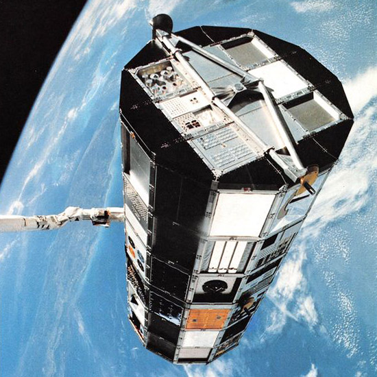
A close-up view of a panel from the Long Duration Exposure Facility
(LDEF) spacecraft. Credit: NASA JSC.
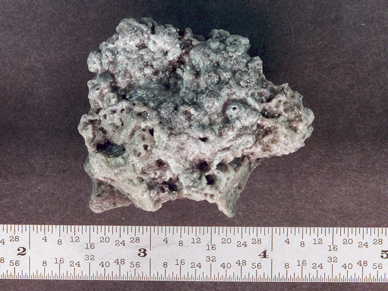
Solid rocket motor (SRM) slag. Aluminum oxide slag is a byproduct of SRMs.
Credit: NASA.
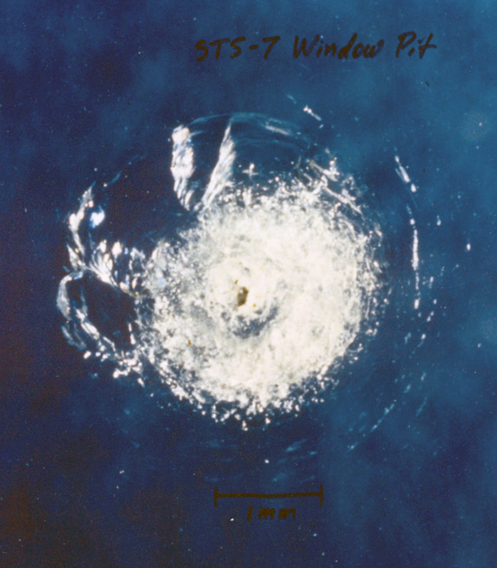
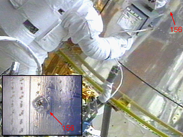
Window pit from orbital debris on STS-007. Credit: NASA.
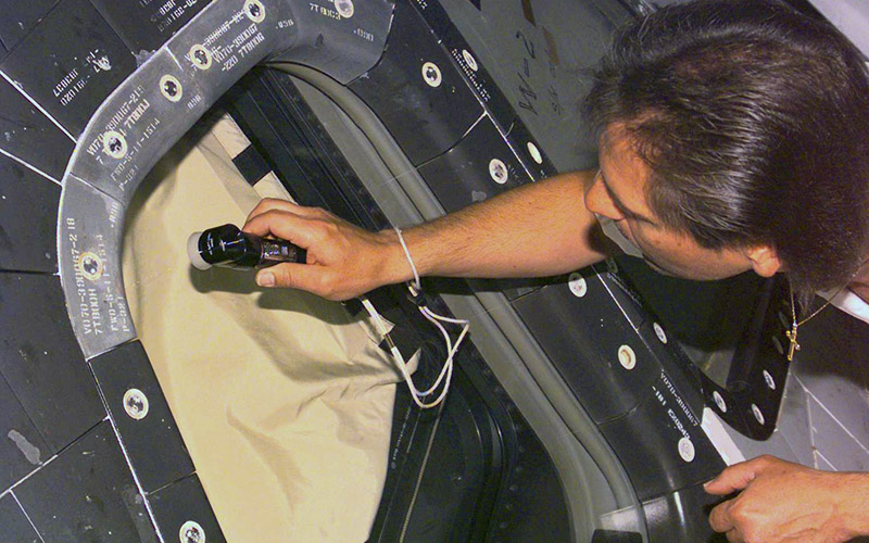
Orbital debris damage seen during Hubble Space Telescope repairs. Credit: NASA.
After in-space repairs to the Hubble Space Telescope,
the returned parts show many orbital debris impacts.
Credit: NASA.
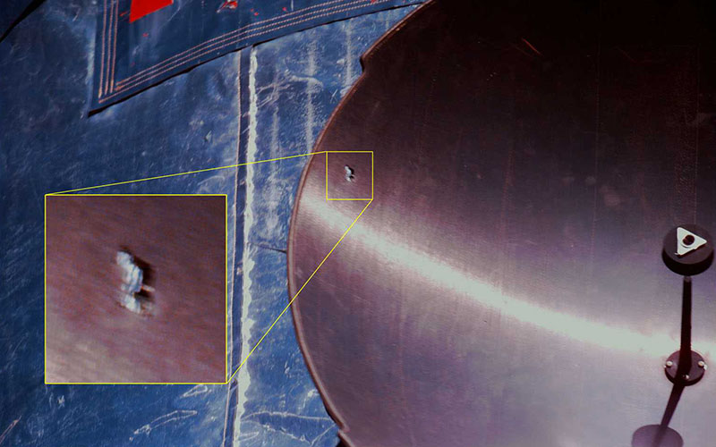
An impact that completely penetrated the antenna dish of the Hubble Space Telescope.
Credit: NASA.
Space Shuttle window being inspected for orbital debris impacts.
Credit: NASA.
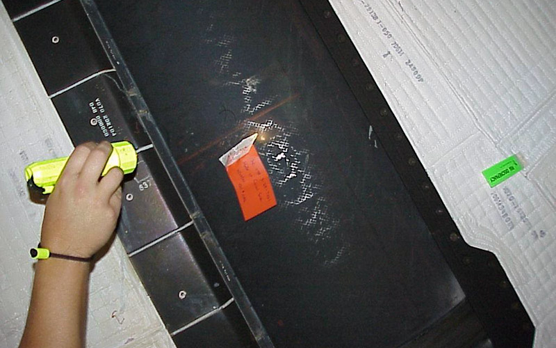
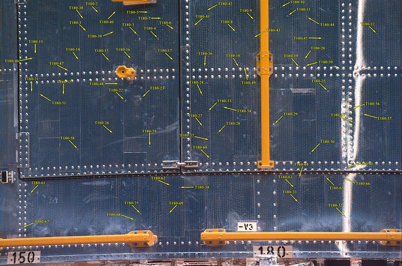
STS-092 vertical stabilizer damage from orbital debris.
Credit: NASA.
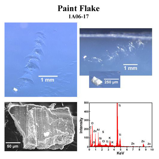
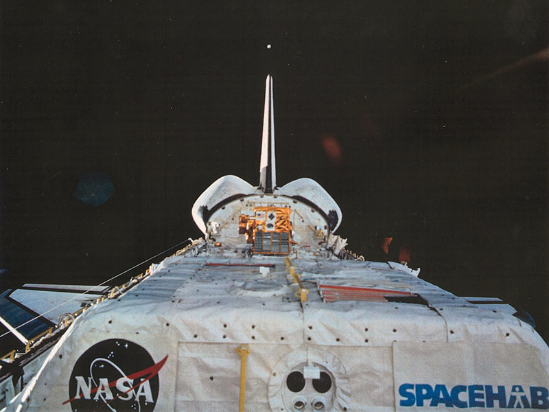
Paint flakes captured by Mir Environmental Effects Payload (MEEP). Credit: NASA.
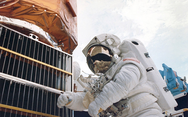
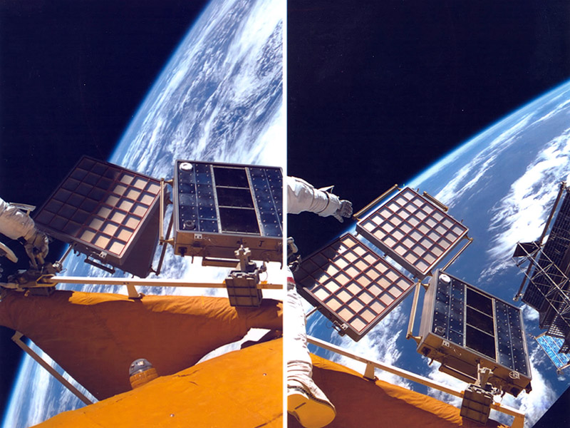
Solar Max satellite repair. Several metal louvers and thermal blankets
were returned from the Solar Max satellite. Credit: NASA.
Mir Environmental Effects Payload (MEEP) Orbital Debris Collector
(ODC) was exposed
to the space environment for
18 months. Credit: NASA.
to the space environment for
18 months. Credit: NASA.
View of an orbital debris hole made in the panel of the Solar Max experiment.
Credit: NASA.
Long Duration Exposure Facility (LDEF) was left in low Earth orbit for
5.7 years before being retrieved by space shuttle Columbia in January 1990.
Credit: NASA.
Orbital Debris Radar Calibration Spheres (ODERACS) experiment deployed spheres and
dipoles from the Shuttle to calibrate the Haystack orbital debris radar measurements.
Credit: NASA.
Reentry
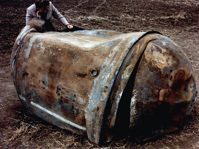
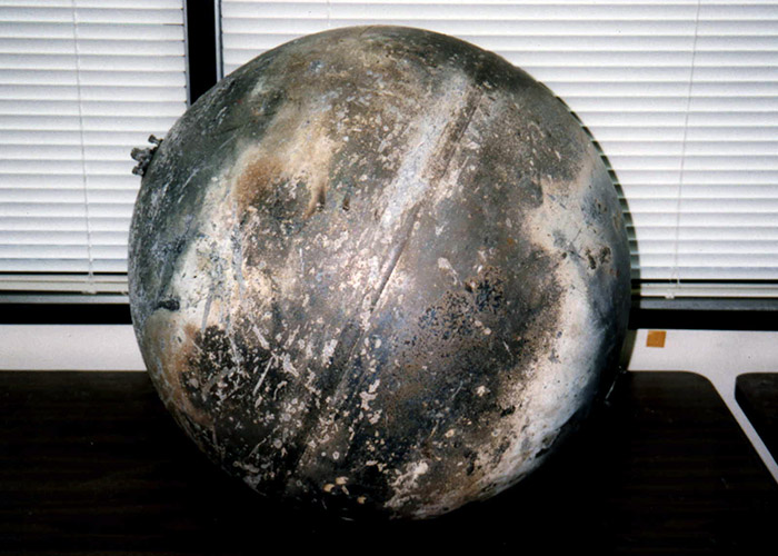
This is the main propellant tank of the second stage of a Delta 2
launch vehicle which landed near Georgetown, TX, on 22 January 1997.
Credit: NASA ODPO.
This 30 kg titanium pressurant tank also survived the reentry of the
Delta 2 second stage but was found farther downrange near Seguin, TX.
Credit: Space Research Institute, King Abdulaziz City for Science and
Technology, Riyadh, Saudi Arabia.
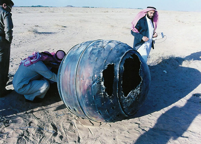
On 21 January 2001, a Delta 2 third stage, known as a PAM-D (Payload
Assist Module - Delta), reentered the atmosphere over the Middle East.
Credit: Space Research Institute, King Abdulaziz City for Science and
Technology, Riyadh, Saudi Arabia.